Photos | The Map of Ving of Nang
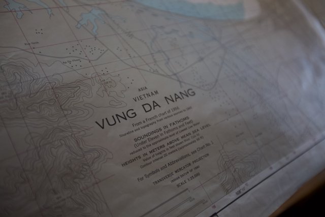
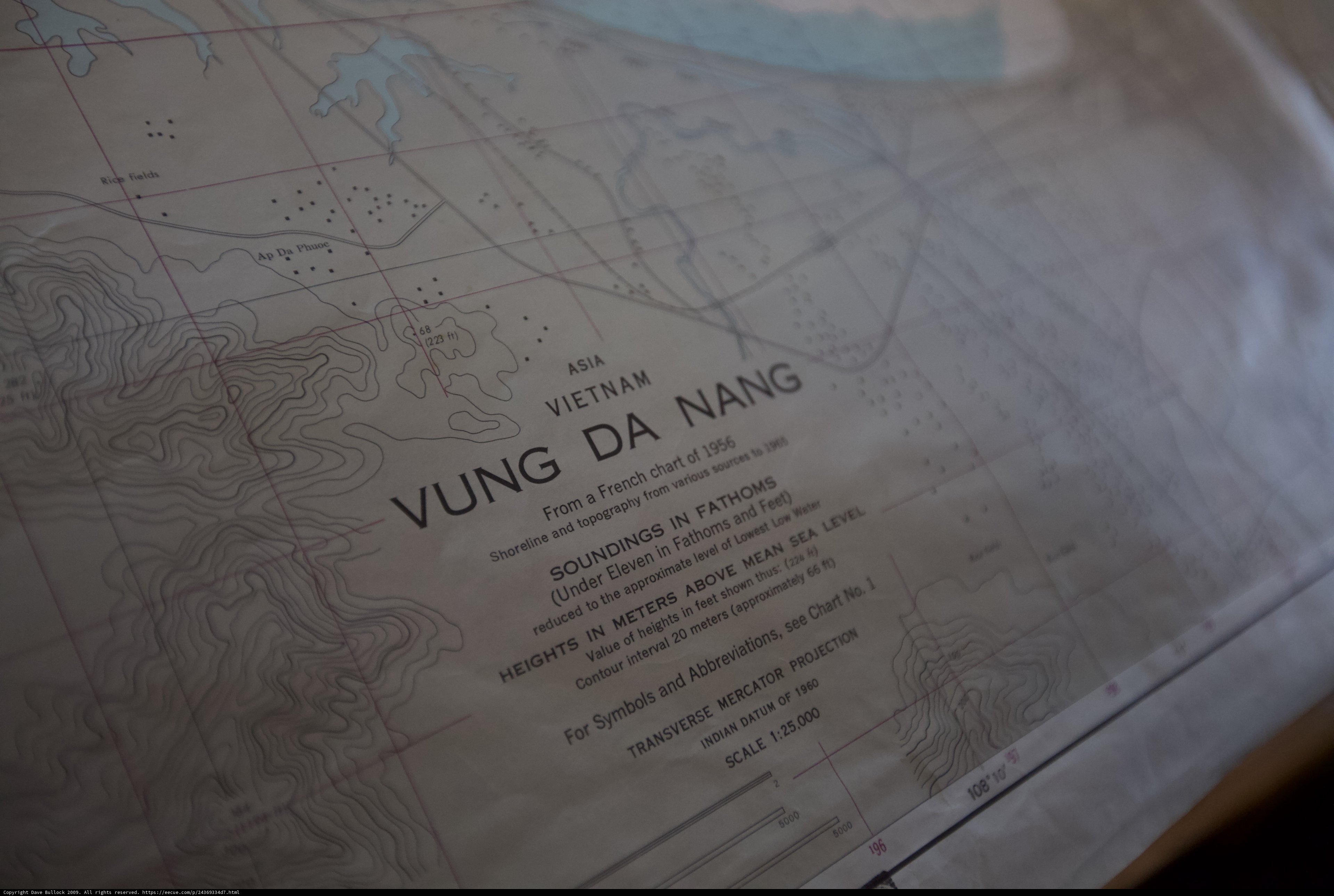
A printed page of the Ving of Nang map, charting out the land and its hidden treasures.
BLIP-2 Description:
a map of the ving of nang is displayed on a tableChronologically Adjacent
Note: You can also navigate with your arrow keys or swiping.
Metadata
Capture date:
Original Dimensions:
5616w x 3744h - (download 4k)
Usage
Dominant Color:
nang plot see white soundings vietnam interval projection value water shown reduced outer asia indian fathoms da no scale atlas topography transverse heights sources approximate document various shoreline contour diagram meters level abbreviations eleven datum vacation french vung astronomy space lowest k feet mean sf thus board approximately mercator text printed low map page chart symbols ff sea
Detected Text
1 10 108 1956 196 1960 1965 20 224 25,000 5000 66 approximate abbreviations asia chart contour da datum ff french fathoms heights indian interval k lowest low mercator meters nang projection scale shown soundings shoreline symbols transverse under value vietnam vung a above and approximately eleven feet for from in level mean no of reduced sea see sources the thus to topography various water
iso
1600
metering mode
5
aperture
f/2.8
focal length
35mm
shutter speed
1/200s
camera make
Canon
camera model
lens model
overall
(3.10%)
curation
(25.00%)
highlight visibility
(1.99%)
behavioral
(10.07%)
failure
(-2.29%)
harmonious color
(-2.58%)
immersiveness
(0.20%)
interaction
(1.00%)
interesting subject
(-91.06%)
intrusive object presence
(-8.94%)
lively color
(-10.86%)
low light
(3.96%)
noise
(-3.54%)
pleasant camera tilt
(-13.44%)
pleasant composition
(-54.35%)
pleasant lighting
(-40.94%)
pleasant pattern
(2.00%)
pleasant perspective
(-11.37%)
pleasant post processing
(0.31%)
pleasant reflection
(-6.86%)
pleasant symmetry
(0.88%)
sharply focused subject
(1.66%)
tastefully blurred
(11.66%)
well chosen subject
(-4.06%)
well framed subject
(-6.32%)
well timed shot
(-3.89%)
all
(-9.39%)
* WARNING: The title and caption of this image were generated by an AI LLM (gpt-3.5-turbo-0301
from
OpenAI)
based on a
BLIP-2 image-to-text labeling, tags,
location,
people
and album metadata from the image and are
potentially inaccurate, often hilariously so. If you'd like me to adjust anything,
just reach out.